Japan's Coastline
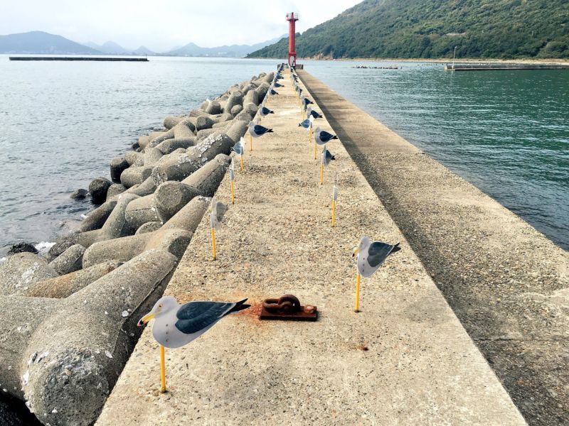
Japan has a strong relationship to its coastline. Considering 70% of the archipelago is the uninhabitable forested mountain, much of the culture is drawn towards the coastline. To successfully live in the area, the Japanese are in tune to its behavior. Climate Change has created the largest change in Japanese coastlines, affecting the safety of those living around them. While money is also being invested in reversing climate change, protecting those from the inevitable increased weather disasters is equally important. This was further prompted by the 2011 Tohoku earthquake and following tsunami. It has taken years to repair the damage and one of the biggest investments in reinforcing the coastlines was building Tetrapods. "four-footed, porous, concrete 'breakwater barrier' used to prevent erosion and water damage by dissipating waves," Tetrapods are 10 tons each and are built a stones throw away from the real coastline to absorb most of the impacts caused by waves and possibly larger tsunamis. Like cousins to sea walls, tetrapods are designed like massive puzzle pieces that don't wash away from strong waves the way piled up stone walls traditionally would. Tetrapods are produced specifically for Japan's unique coastlines; they drop quickly as a continuation of the steep mountainous shape the islands take. This sharp line and close proximity to shifting tectonic plates leave the area extremely vulnerable but Tetrapods are the key investment to protect such an exposed coastline.

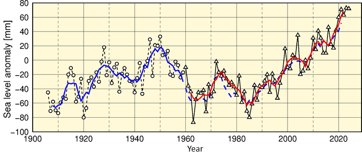
Another way Japan copes with changes to their coastline has been by studying it carefully for over 100 years. The more extensive the research, the more broad understanding scientists can have on the state of the country's coastlines and better predict and adapt to future changes. Beginning in 1906, the Japan Meteorological Agency has been tracking sea level rise.
 |
The solid blue line represents the five-year running mean of annual sea level anomalies averaged among the four stations, while the solid red line represents the corresponding value for the four regions. The dashed blue line represents the value at the four stations for the same period shown by the solid red line (from 1960 onward) for reference.
|
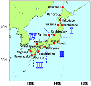
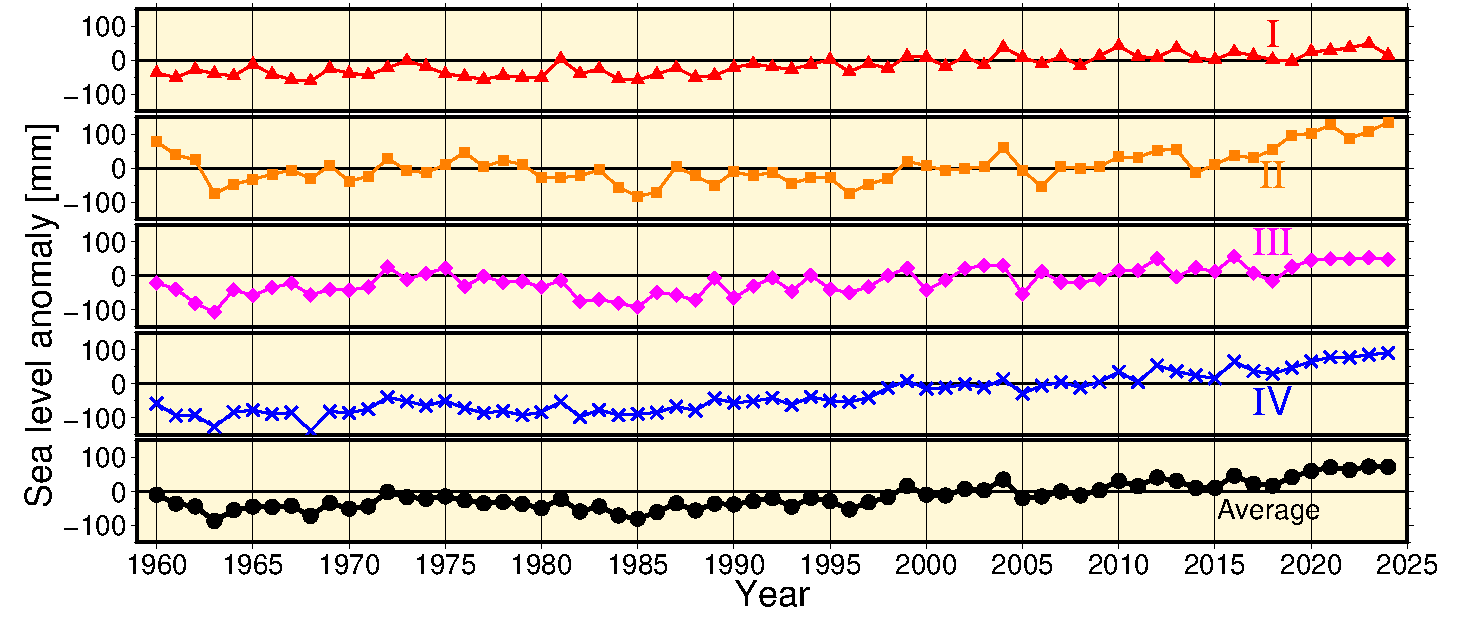
They further break down the extensive 29,751 km long coastline into 77 individual coastal zones divided into four overall regions. These regions are depicted on the map with the graph below showing the four-century-long coastline changes. Overall, JMA hasn't reported significantly hazardous SLR, however, there have been individual studies that prove coastline loss from erosion. A 2000 study observed that 49% of beach loss due to SLR of 0.3m per year and 93% for an SLR of 1.0m. There are further studies that are making predictions into the next century however the different methods conflict so results are inconclusive.


Sources:
https://arstechnica.com/science/2016/11/covering-coasts-with-concrete-japan-looks-to-tetrapods-to-battle-elements/
https://www.data.jma.go.jp/gmd/kaiyou/english/sl_trend/sea_level_around_japan.html
https://www.sciencedaily.com/releases/2017/07/170713154919.htm
http://www.jcronline.org/doi/abs/10.2112/SI72-009.1?journalCode=coas

Comments
Post a Comment